
Reviewed · PEAK DISTRICT TOURS
Map Reading and Navigation Course in Peak District
A compass can change your whole day. This one-day course in the Peak District turns map reading from a vague outdoor chore into a usable hill skill, with classroom guidance at the Adventure Hub and practical work on nearby tracks and moorland. I like the small groups of up to eight and the fact that you spend most of the day putting theory into practice, not just sitting indoors.
I also like the friendly, patient teaching style reported from instructors including Gavin, Rick, Paul, Guy, and Richard. The main consideration is simple: lunch is not included, and the course runs in all weather, so you need to bring food and dress for a proper day outside.
- Starts with map basics: Learn scales, grid references, rights of way, and how maps show the ground.
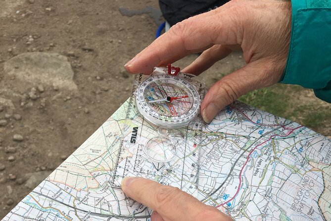
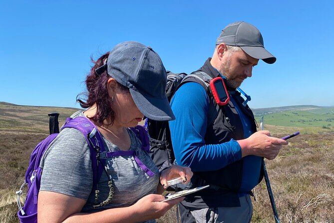
- Compass skills are practical: Use a compass to set the map and check direction rather than merely hearing a classroom explanation.
- Based at the Adventure Hub: The Bamford setting puts you close to Peak District hills and moorland.
- Small class size: A maximum of eight people gives the instructor room to help with individual mistakes.
- Designed for beginners: The course suits people preparing for self-guided walks or refreshing long-forgotten skills.
- Tea and coffee included: Useful before and during a full day outdoors, though you need to arrange your own lunch.
In This Review
- Starting at 9:30 in Bamford
- Learning the map before taking a bearing
- Using different compasses on the Peak District hills
- From indoor theory to outdoor practice
- What the small group changes
- Is $136.73 good value for one day?
- Who will get the most from this course?
- Practical points before you book
- Should you book the Bamford navigation day?
- FAQ
- Where does the navigation course start?
- What time does the course begin?
- How long does the course last?
- Is lunch included?
- Does the course run in bad weather?
- How many people can join the course?
Starting at 9:30 in Bamford
The course begins at 9:30 am in Bamford, in the Hope Valley, at the Adventure Hub operated by Pure Outdoor Ltd. This is a useful base for a navigation course because the hills and open ground are close by, allowing the day to move from explanation to practice without wasting much time on transport.
You return to the same meeting point at the end. That makes the day straightforward if you are driving or arranging a lift, and the site has parking according to the available course information. It is also near public transport, though you should check your own route and timetable before setting out.
The mobile ticket is handy for arrival, and confirmation normally comes at booking. If you book within seven days of the course, confirmation can take up to 48 hours and remains subject to availability, so a last-minute booking needs a little patience.
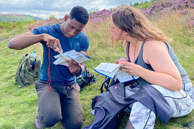
The group limit is eight. That matters more here than it would on a sightseeing tour. Navigation involves small corrections: holding the map the right way, matching a feature on the ground, taking a bearing, or working out why your direction has drifted. In a large group, those details can be rushed. With eight or fewer, you have a better chance to ask questions and practise until the method makes sense.
Learning the map before taking a bearing
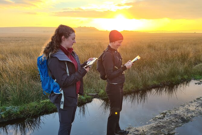
The first part of the day covers the building blocks of navigation. You work with maps, scales, grid references, and rights of way before heading into more practical compass work.
That order is sensible. A compass does not tell you where you are by itself. It helps you keep direction, but you still need to understand the map and identify features around you. The course aims to show how those tools fit together, rather than treating compass use as a stand-alone trick.
Map scale is one of the most useful subjects for a new walker. It helps you judge how far a route really is and gives you a better feel for the time and effort involved. Grid references then provide a way to describe a precise place on the map. This can help with planning, communicating your position, and checking that you are following the intended route.
Rights of way are another valuable part of the syllabus. On a UK walking map, a public footpath, bridleway, restricted byway, or other route marking has a practical meaning. Understanding these markings helps you make better route choices and avoid treating every visible path as equally suitable.
The course is aimed at beginners, but it also suits someone who has walked for years using marked paths and now wants more independence. You may already know how to follow a trail, yet still feel uncertain when the path becomes faint or the weather reduces visibility. The map work gives you a more reliable way to make decisions.
More Peak District trips:
- Outdoor Rock Climbing Taster Day in Peak District
★ 5.0 · 74 reviews - Derbyshire & the Peak District from Manchester
★ 4.5 · 64 reviews - 6hr Small Group Peak District eBike Tour
★ 5.0 · 39 reviews
Using different compasses on the Peak District hills
You learn about different types of compasses and how to use them. The key lesson is not simply identifying the equipment. It is learning how to set the map, check direction, and use the compass alongside what you can see around you.
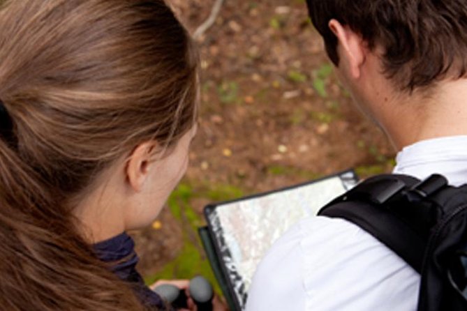
Setting the map means orienting it to match the real world. Once the map is aligned, features on the paper have a clearer relationship to the hills, paths, and other points around you. This can make the map far less confusing for someone who has previously turned it in circles and still felt lost.
Checking direction with a compass gives you a way to confirm your route. That is especially useful when several paths appear to head in roughly the same direction, or when a clear view is not available. The course does not promise that one day will make you an expert in every condition. It gives you a working foundation and time to repeat the basic actions.
This practical approach received the strongest praise from people who had either never used navigation tools or had not touched a compass for decades. That is an important clue about the level. You do not need to arrive as an outdoor expert, and you will not be expected to remember school geography.
Instructors such as Gavin were praised for creating a relaxed atmosphere, while Paul was singled out for making the day both informative and enjoyable. Guy was noted for adjusting the day to suit the group. Those details suggest a teaching style that leaves room for questions rather than pushing everyone through a rigid script.
From indoor theory to outdoor practice
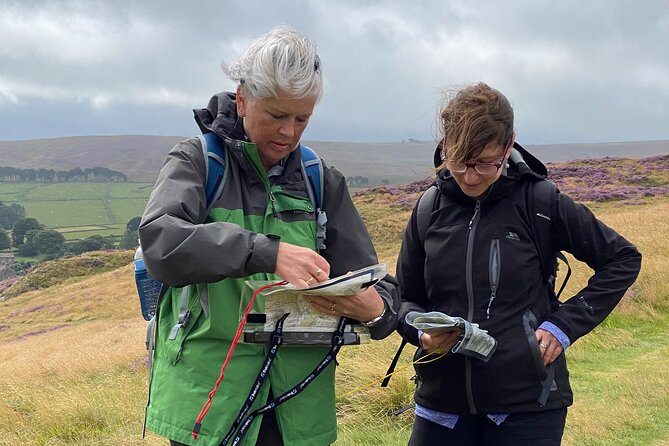
The Adventure Hub provides the starting point, but the course is not intended to remain indoors. Most of the day takes place in the hills and moorland around the facility, where you can apply the ideas to real ground.
That change of setting is what gives the course its value. A map exercise on a table is useful, but outdoor navigation adds the problems you actually face on a walk. You need to connect a marked feature with something visible, keep track of direction, and decide how the route on paper relates to the ground beneath your boots.
The Peak District is a fitting classroom. Its tracks, paths, hills, and open moorland provide the sort of varied setting in which map and compass skills become relevant. You are not simply memorising instructions. You are working out how to use them while moving through a real walking area.
The precise route is not stated, and that is probably sensible for a teaching day. The instructor can choose ground that suits the group and the weather. You might find the practical exercises easier in clear conditions, while mist, wind, or rain can make direction and distance harder to judge.
The course operates in all weather. That is both a warning and part of its usefulness. British hill walking does not come with a guarantee of sunshine, and navigation matters most when visibility or comfort is reduced. Still, you should take the warning seriously. Wear suitable outdoor clothing and footwear, and bring enough food and drink for the day.
Coffee and tea are provided, which is a pleasant touch at the training base. They are a comfort rather than a replacement for lunch. Since lunch is not included, pack something substantial and easy to eat outdoors or at an appropriate break.
What the small group changes
A maximum of eight people creates a more personal learning environment than a large commercial excursion. You can watch the instructor demonstrate a skill, try it yourself, and ask for correction before a simple mistake becomes a bad habit.
Navigation is often less intimidating when you are allowed to get something wrong. A compass course should give you time to check your work, compare your direction with the map, and understand the reason for an error. The available feedback repeatedly highlights clear explanations, encouragement, and time to practise.
The teaching also appears adaptable. One course participant described strong support for a group member who was deaf and relied on lip reading. That points to a considerate approach, though you should still contact the provider in advance if you have specific access requirements and want to confirm what support is available for your situation.
Most people can take part, and service animals are allowed. The course is still an outdoor hill activity, so you should consider your own mobility, stamina, and comfort on uneven ground before booking.
A completely different sort of day out:
- Stonehenge, Windsor Castle, and Bath from London
★ 4.5 · 18,662 reviews - London Big Bus Hop-On Hop-Off Tour with Optional River Cruise
★ 3.5 · 10,803 reviews - London Small Group Tour of Historical Pubs
★ 5.0 · 10,422 reviews - Beatles Magical Mystery Tour
★ 5.0 · 9,266 reviews
Is $136.73 good value for one day?
At $136.73 per person, this is not the cheapest way to spend a day in the Peak District. You could walk the hills for nothing, and a printed map or compass costs less than a guided course.
The value comes from the instruction. You are paying for a professional guide, a structured introduction, access to a suitable training base, practical time outside, and a small group rather than a crowded lecture. If the course helps you plan and complete future walks without paying for a guide, the cost can make sense over time.
It is also a useful option for someone who has bought outdoor equipment but lacks confidence using it. A compass in a rucksack is not much help until you know how to orient the map and check your direction. The same is true of a navigation app. One piece of feedback praised an offline map and navigation app, but digital tools do not remove the value of understanding the basic relationship between map, direction, and ground.
The price makes most sense if you intend to walk independently in the UK. It is less compelling if you only want a scenic day in the Peak District, since the teaching is the main purpose and not an added extra.
The course is also marketed as a taste of the skills needed for self-guided walking. It is not presented as an advanced qualification. If you want a formal progression, Pure Outdoor also offers longer navigation courses, including NNAS Bronze and Silver options. The one-day experience is best viewed as a first step, a refresher, or a way to decide if you want to continue.
Who will get the most from this course?
I would recommend it most strongly to:
- A beginner who wants to move beyond well-marked paths
- A regular walker whose map and compass skills have faded
- Someone planning independent hill walks in Britain
- A visitor looking for an active Peak District day rather than a standard sightseeing tour
- A gift buyer seeking something useful and outdoorsy
- A small group that prefers patient instruction and practical exercises
It may not suit you if you want a relaxed scenic walk with little teaching. The day is built around learning, practising, and checking navigation skills. It can also be demanding if you are not prepared for outdoor conditions, since the activity continues in rain and other weather.
The course is offered in English. That is worth noting if you are more comfortable learning technical instructions in another language, since map and compass work depends on clear explanations.
Practical points before you book
Plan to arrive ready for 9:30 am in Bamford. Since the course ends back at the meeting point, you do not need to arrange a separate pickup at another location.
Bring lunch, outdoor clothing, and suitable footwear. The provider supplies tea and coffee, but the information does not specify other equipment, so ask Pure Outdoor what you need to bring and whether any navigation tools are supplied.
The activity is often booked around 69 days ahead. That does not mean you must reserve exactly that far in advance, but it suggests that popular dates may fill early, especially if you want a particular weekend.
Free cancellation is available if you cancel at least 24 hours before the start time. Changes or cancellations inside that window are not accepted for a refund, and the course requires a minimum number of people to run. If the provider cancels because that minimum is not reached, you are offered another date or experience, or a full refund.
Should you book the Bamford navigation day?
Book it if you want a practical start in map reading and compass use, especially if you hope to walk the Peak District or other UK hills without relying entirely on signs or phone signal. The small group, outdoor practice, and patient instruction from guides such as Gavin, Rick, Paul, Guy, and Richard give the day a strong learning focus.
I would be more cautious if you want only a hike, dislike learning in poor weather, or are looking for an advanced navigation qualification. For everyone else, $136.73 is a fair price for a focused one-day course that can make future walking safer, calmer, and more independent.
FAQ
Where does the navigation course start?
It starts at the Adventure Hub in Bamford, Hope Valley, Sheffield, England. The listed meeting point is Bamford, Hope Valley S33, UK.
What time does the course begin?
The course starts at 9:30 am.
How long does the course last?
It lasts approximately one day and finishes back at the meeting point.
Is lunch included?
No. Coffee and tea are included, but lunch is not, so you need to bring or arrange your own lunch.
Does the course run in bad weather?
Yes. The activity operates in all weather conditions, so you should dress appropriately for outdoor conditions.
How many people can join the course?
The maximum group size is eight people. Most people can participate, and service animals are allowed.
Just added in England
- Private Tour: Royal High Tea At Kensington Palace Gardens★ 5.0 · 39 reviews
- Private Tour: Personal Travel Photographer Tour in London★ 4.5 · 27 reviews
- London East End Private Walking Food Tour – Secret Food Tours★ 5.0 · 26 reviews
- Private Tour: Night Photography Tour in London★ 5.0 · 48 reviews
- London Like a Local, Private & Personalized (2-3 hrs)★ 4.5 · 11 reviews
- British Museum & National Gallery of London – Exclusive Guided Combo Tour★ 5.0 · 48 reviews
- Private Tour: Tower of London and St Paul’s Cathedral★ 5.0 · 1 review
- London Soho District – Exclusive Guided Walking Tour★ 5.0 · 2 reviews
Peak District Tours, compared.
Outdoor Rock Climbing Taster Day in Peak District
Read our review →
Peak District: Fun Puzzle Treasure Hunt to a Pub!
Read our review →
Peak District Tour App, Hidden Gems Game and Big Britain Quiz (7 Day Pass) UK
Read our review →Browse the lists this tour appears in